OBJECTIVES
Marine habitats provide various functions that are essential for fish: feeding areas, spawning grounds or nurseries for juvenile stages. In the underwater landscape mosaic, these functions are provided by various habitats, thus complementary, and different according to the species. In addition to adult population management, it is therefore necessary to preserve these habitats which are essential to the species life cycles.
From the point of view of judicious prioritization of conservation objectives, it is thus necessary to better understand the role and distribution of these key habitats, spawning grounds and nurseries. In this context the MedHab project (2019-2022) aims to locate and quantify the availability of certain marine habitats fulfilling an essential nursery function. This project, financed under the 2018 call for research projects led by the DIRM (Direction Interrégionale de la Mer), is one of the concretizations of the Mediterranean PAMM (Action Plan for the Marine Environment). The PAMM is itself a declination of the DCSMM (Framework Directive Strategy for the Marine Environment) aimed at achieving or maintaining the good environmental status of marine environments.
DESCRIPTION
The actions of the MedHab project, led by Septentrion Environnement since January 1st, 2019, are organized into “Workpackages” (WPs) and are implemented at two working scales: the French Mediterranean coastline as a whole, and three areas with MPAs, used as case studies.
WP1
Gather and analyze data available in the literature on Teleost spawning and nursery habitats.
WP2
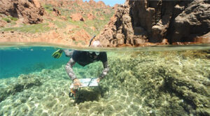
On the whole coastline, we aim to locate and quantify the sparid nursery habitats (shallow rocky bottoms) and evaluate their current management consideration. Carry out field verifications of this mapping, including a census of the juvenile populations. In addition, in the three study areas, the goal is to estimate the relative availability and the recruitment potential of this habitat with respect to two other types of nursery habitats (Posidonia meadow and shallow rocky bottoms).
WP3
To ensure a transfer of skills and acquired knowledge to the managers by the realization of online databases, training, and to raise awareness among the general public.
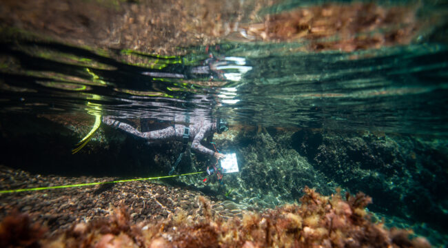
In 2019, 2020 and 2021, these mapping and ground truth campaigns have validated the method of mapping shallow rocky bottoms via satellite imagery. These field campaigns also allowed the characterization of juvenile assemblages. This was carried out in three pilot areas in Provence, Corsica and Occitania, including the Calanques National Park, the Côte Bleue Marine Park, the Scandola Nature Reserve, the Gulf of Calvi, the Cerbère Banyuls Marine Nature Reserve and the Gulf of Lion Marine Nature Park.