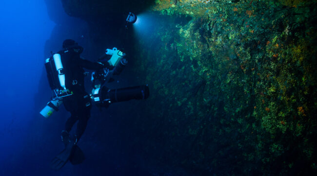
Photogrammetry makes it possible to reconstruct a three-dimensional model of an underwater landscape or organisms from a series of photographs. By producing accurate, georeferenced 3D models, it allows us to measure and track changes in marine ecosystems without disturbing them. Its scientific value stems from the ability to maintain a digital archive of the studied environments, which can be analyzed over time in light of emerging scientific questions.
At the Landscape Scale
At the landscape scale, photogrammetry enables the precise documentation of the structure of underwater habitats and their spatial organization. The resulting 3D models serve as reference points that can be compared over time to track environmental changes linked to global shifts and human-induced pressures. This approach is particularly well-suited for monitoring habitats such as coralligenous ecosystems, and also makes it possible to document sites that are difficult to access or located at great depths.
Some of Our Projects
Les Pharillons – Île Maïre, Calanques National Park
As part of the EXPLOR’HAB project, we created a 3D model of Les Pharillons, from the surface down to a depth of 45 meters, covering more than 100 meters of cliff face. More than 100,000 photographs were taken during 24 dives.
Le Tombant du Planier – Calanques National Park
The photogrammetric survey of the Planier drop-off, at depths between 10 and 40 meters, required the acquisition of more than 9,000 photographs.
L’Impérial du Large – Riou Archipelago, Calanques National Park
The deep section of the Imperial du Large, between 30 and 60 meters, was also the subject of a high-resolution 3D survey based on more than 6,000 photographs. This model makes it possible to accurately document the structure of this iconic site and to plan for its long-term monitoring.
At the level of communities and sessile species
We also use photogrammetry to study the structure and dynamics of populations of sessile species, particularly red coral (Corallium rubrum). In collaboration with the LIS, we have developed a methodology and specific tools to monitor these populations over time, particularly within various Marine Protected Areas: the Calanques National Park, the Cerbère-Banyuls Marine Nature Reserve, and the Gulf of Lion Marine Nature Park.
Photogrammetry provides precise three-dimensional measurements without touching or disturbing the colonies. It also allows us to collect a large amount of data during a single dive and to archive the surveys so that new measurements or analyses can be performed several years after data collection.
These long-term monitoring efforts thus provide a better understanding of population dynamics and their habitat, allow for the study of how they evolve in response to environmental disturbances, and enable the evaluation of the effectiveness of management measures implemented for their conservation. The 3D models also facilitate the study of species associated with communities dominated by red coral.